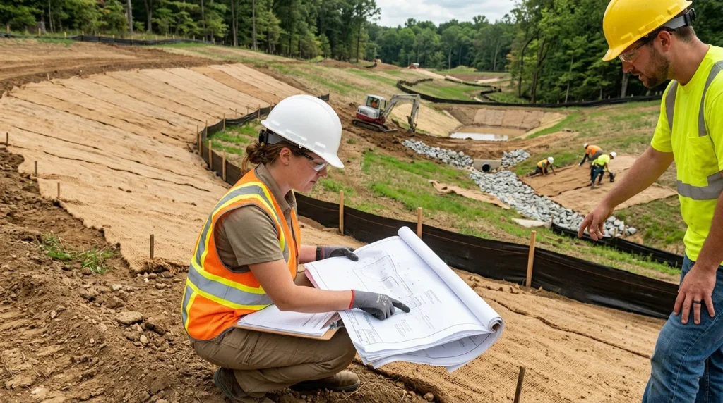
Quick answer: An erosion control plan is a site-specific set of drawings and notes showing how you’ll keep soil from leaving a property during construction or land disturbance. You typically need one before clearing, grading, excavation, or driveway and utility work, and it’s often tied to local permits and inspections. It also reduces muddy runoff, street tracking, and enforcement issues by spelling out controls, sequencing, and maintenance.
What the Plan Usually Includes
An erosion control plan is more than “throw down some hay.” It lays out where runoff will flow, where soil is likely to move, and exactly which temporary controls go in before the first scoop of dirt. A good plan matches the site’s slopes, soils, and drainage patterns so the controls work with the terrain instead of fighting it.
Most plans include a base map of existing conditions, the limits of disturbance, and a sequence of construction (what gets installed first, what gets stabilized next). You’ll usually see measures like silt fence or compost filter socks on the downhill edges, a stabilized construction entrance to keep mud off the road, inlet protection around nearby catch basins, and temporary seeding or mulch on exposed areas. Notes often specify installation details—like trenching in silt fence, spacing check dams in swales, and how quickly bare soil must be stabilized after grading.
Do I Need One? Quick Checklist
You’re more likely to need an erosion control plan if any of these apply. Confirm with your town/state, since triggers and thresholds vary by jurisdiction.
- You’ll disturb roughly 5,000–10,000 sq ft or more of soil (some places use smaller or larger cutoffs).
- You’ll disturb 1 acre or more total (often a key threshold for state/federal stormwater programs).
- Work is within a locally regulated buffer to wetlands/streams (a typical range is 50–200 ft, depending on the resource and rules).
- You’re adding new impervious area (driveway, patio, roof expansion) that changes runoff patterns.
- Runoff from the work area can reach a catch basin, storm drain, ditch, or culvert.
- Slopes are steep (a typical trigger is sustained slopes around 10–15% or higher) or there’s a long downhill flow path.
- Soils are highly erodible, or the site has a history of muddy discharge or sediment on the road.
When It’s Required (Typical Thresholds)
Local requirements are usually tied to how much land you disturb, how close you are to sensitive resources, and whether you’re changing drainage. A typical local review kicks in somewhere around 5,000–10,000 sq ft of disturbance, or any disturbance inside a wetland/stream buffer, but the exact numbers and definitions vary by jurisdiction.
Separate from local rules, many state/federal construction stormwater programs use 1 acre of total disturbance as a common threshold for additional paperwork and controls. Smaller projects can still trigger requirements if they discharge to a municipal storm system, involve steep slopes, or sit near wetlands, streams, or flood-prone areas. The fastest way to avoid rework is to confirm the exact submittal package your town/state expects before you finalize drawings.
Erosion Control Plan vs Stormwater Plan vs SWPPP/NOI
These documents get mixed up because they overlap in goals but differ in scope. An erosion control plan focuses on temporary measures during construction to keep soil on site—perimeter controls, inlet protection, stabilized entrances, temporary stabilization, and maintenance.
A stormwater management plan usually addresses the post-construction condition: how runoff will be handled permanently with grading, drainage structures, infiltration or detention, and long-term stabilization. It may include calculations and details that go beyond temporary erosion controls.
A SWPPP (Stormwater Pollution Prevention Plan) is a broader compliance document used where construction stormwater permits apply. It typically includes the erosion/sediment controls, plus inspection logs, responsible parties, spill prevention, material handling, and a site map. An NOI (Notice of Intent) is the permit filing that may be required to obtain coverage under a construction stormwater permit, depending on your state and project size.
What to Do Next and How to Be Inspection-Ready
Use a simple flow to keep things moving: call the building department and, if applicable, the conservation commission → confirm exactly what must be submitted (erosion control plan, stormwater plan, SWPPP/NOI, details, calculations) and the disturbance threshold they use → gather a current survey/topo and identify limits of disturbance and resource buffers → prepare the plan with sequencing and a maintenance routine → schedule work so controls are installed before clearing and grading.
Before the first inspection, run a quick readiness check: limits of disturbance are staked/flagged; stabilized construction entrance is in; perimeter controls are installed in the right locations and trenched/keyed; inlets are protected; stockpiles are covered/contained; and stabilization materials (seed, mulch, blankets) are on site. For help putting together the right package and getting it field-practical, contact Haughawout Engineering & Markets.